Getting Around Singapore: MRT Map, Buses, Taxis & Payment Guide
Use Singapore MRT, buses, taxis and Sentosa transport with clear payment, transfer, airport, stroller and accessibility guidance.


Singapore’s public transport is extensive and easy to use, but heat, sudden tropical downpours, and long walks inside large interchanges can still drain your energy. A sensible mode strategy matters, especially with children, luggage, or limited mobility.
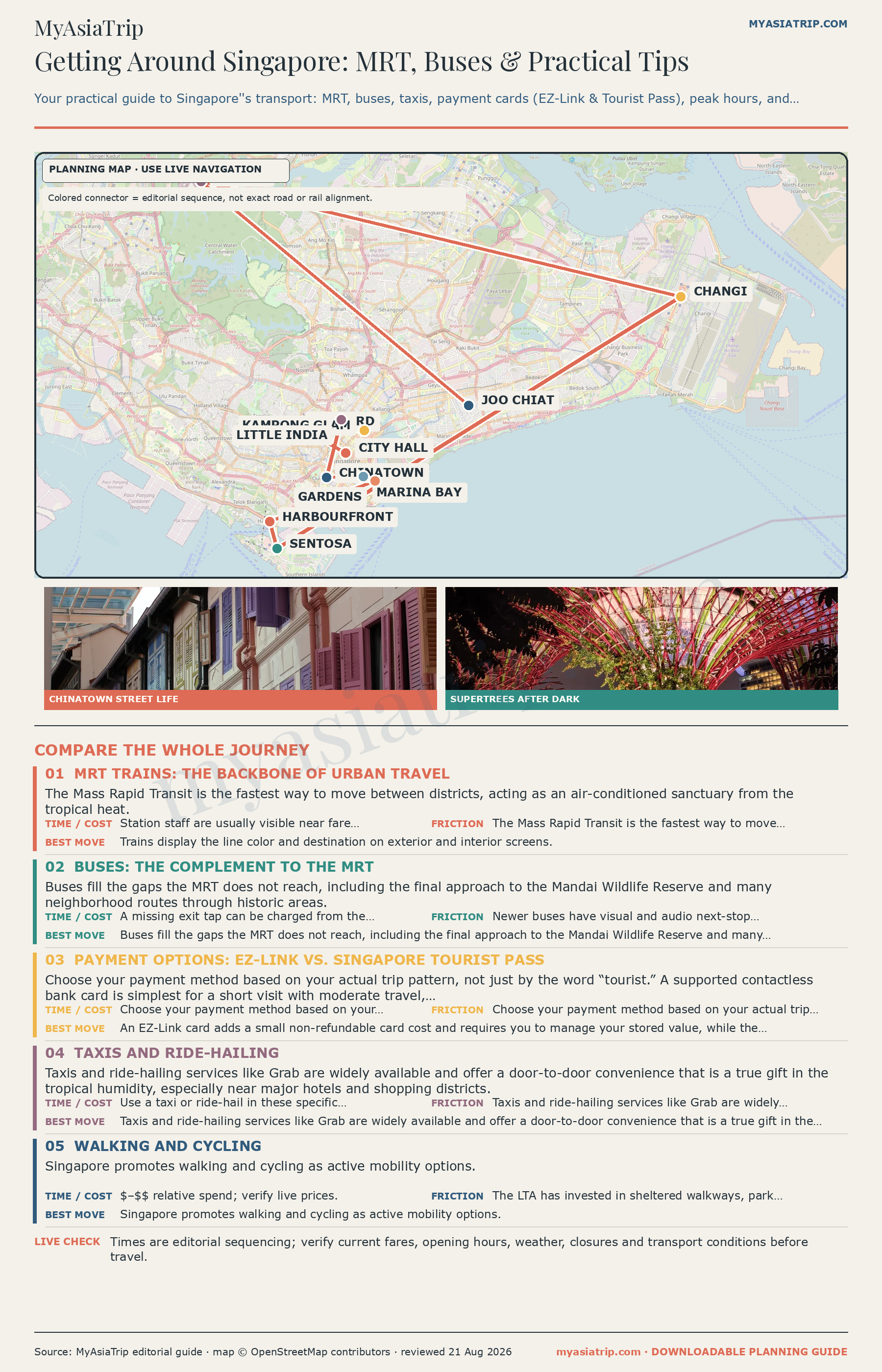
The most practical, low-stress strategy for getting around Singapore revolves around three distinct layers: use the Mass Rapid Transit (MRT) network for swift, air-conditioned cross-city journeys; rely on the comprehensive public bus system for the “last mile” to historic quarters, botanical gardens, and neighbourhood dining strips; and switch to metered taxis or on-demand ride-hailing when travelling with heavy luggage, navigating sudden rainstorms, or caring for overtired children after a full day on your feet.
Once you understand the integrated fare system, use the same bank card or transport pass to tap in and out, and check the correct underground exit before leaving the station. Those three habits prevent most avoidable delays.
Singapore transport modes at a glance
Singapore offers an interconnected web of rail, road, and water transit options. Selecting the right option depends on your group size, walking tolerance, luggage load, and budget.
| Mode | Best use | Payment method | Luggage & family fit | Main drawback & trade-off |
|---|---|---|---|---|
| MRT (Subway) | Long-distance cross-island travel, avoiding traffic congestion, reaching major commercial districts | Contactless bank card/mobile wallet (SimplyGo), EZ-Link card, Singapore Tourist Pass (STP). No single-trip tickets. | Step-free lifts at all stations; open strollers allowed. Awkward with multiple oversized suitcases during peak commuter hours. | Sprawling underground stations require significant walking; deep lines involve long escalator banks. |
| Public Bus | Short neighbourhood hops, scenic surface journeys, direct connections to heritage districts and nature parks | Contactless bank card, EZ-Link card, STP, exact cash (no change given). | Wheelchair-accessible buses have ramps and a shared wheelchair/stroller space; bulky luggage is awkward. | Slower than rail in traffic; use live navigation so you do not miss your stop. |
| Metered Taxi | Direct point-to-point transit from taxi stands, airport arrivals, late-night returns | Cash, cards and supported electronic payments; airport/CBD/peak surcharges may apply. | Useful with luggage. Taxis are legally exempt from Singapore’s child-restraint rule, although a suitable restraint remains the safer choice. | Queues form quickly during heavy rain and event dispersals; surcharges add up. |
| Ride-Hailing (Grab, Gojek, Tada) | Door-to-door trips called from your phone, with the fare shown before booking | In-app card or supported digital wallet. | Standard and larger-vehicle options vary by app. Private-hire cars require an approved child restraint for passengers under 1.35m. | Fares rise when demand is high; child-seat availability must be checked before booking. |
| Walking & Cycling | Exploring compact heritage quarters and leisurely rides at East Coast Park | Free on foot; rental bicycles usually require an app. | Many central pavements and Park Connectors are stroller-friendly; cyclists must follow path rules and yield where required. | Heat, sun and sudden thunderstorms make long walks tiring. |
| Sentosa Express & Cable Car | Crossing from HarbourFront into Sentosa’s attractions and beach precincts | Sentosa Express has a separate island-entry fare; the cable car requires an attraction ticket. | The monorail is the practical option with a stroller; check current cable-car boarding requirements for mobility devices and bulky pushchairs. | The cable car is a scenic experience rather than ordinary public transport; weekend queues can build at VivoCity. |
| Sightseeing River Cruise | Leisurely historical and architectural viewing along the Singapore River and Marina Bay | Attraction ticketing online or at the operator’s counter. | Ask the operator about step-free boarding and stroller storage before booking. Not practical with luggage. | A sightseeing attraction with a fixed route, not everyday transport. |
How to pay for public transport in Singapore
Singapore’s MRT uses account-based or stored-value payment, while buses also accept exact cash. Understanding the fare options before your first ride avoids unnecessary queues, surcharges and boarding delays.
1. Contactless bank cards and mobile wallets (SimplyGo)
For the vast majority of international visitors, tapping a personal contactless bank card or mobile wallet is the most economical and straightforward method.
- How it works: Simply tap your physical contactless credit card, debit card (Visa or Mastercard), or mobile wallet (Apple Pay, Google Pay, Samsung Pay) against the reader at the MRT fare gate or bus boarding door.
- No registration required: You do not need to download an app or register beforehand to ride. Just tap and go.
- Card-per-person rule: Every individual traveler must use their own unique card or smart device. You cannot tap your contactless card and then hand it back to your partner or child; the system treats each card as an open trip ledger.
- Device consistency: The physical plastic card and the digital card stored on your smartphone or smartwatch carry distinct virtual device account numbers. If you tap into an MRT station with your Apple Watch, you must tap out with the exact same Apple Watch. Tapping out with your physical plastic card will cause the transit gate to register two incomplete journeys, resulting in maximum fare penalties on both.
- Foreign card administrative fees: Under Land Transport Authority (LTA) visitor regulations, foreign-issued Mastercard and Visa cards may incur a flat administrative fee of S$0.60 per day of transit usage. Check your bank’s overseas transaction and currency conversion policies, as foreign bank processing fees may also apply.
2. Stored-value cards: EZ-Link & NETS FlashPay
If you prefer not to use your international credit card, or if your bank charges heavy foreign transaction fees, a prepaid stored-value card is the traditional alternative.
- Where to buy: Stored-value EZ-Link cards can be purchased at MRT station SimplyGo Ticket Offices, Passenger Service Centres, and selected convenience store outlets including 7-Eleven, Cheers, and Buzz kiosks across the city and at Changi Airport.
- Card cost breakdown: At selected convenience stores, a non-SimplyGo EZ-Link card is currently listed at S$10, including S$5 stored value and a non-refundable S$5 card cost. Products and selling locations change, so check the official SimplyGo sales page before relying on a particular branch.
- Topping up: Use supported ticketing machines or authorised retailers; accepted payment methods and minimum top-up amounts depend on the channel.
- Refunding remaining balance: Eligible stored value can be refunded at a SimplyGo Ticket Office. The card cost itself is not refunded, and some cards or expired balances follow different rules—confirm before your final airport journey.
3. Singapore Tourist Pass (STP)
The Singapore Tourist Pass is a dedicated stored-value card offering unlimited travel on Singapore’s basic public bus services, MRT, and LRT trains for 1, 2, or 3 consecutive calendar days.
- Where to buy: Available at designated SimplyGo Ticket Offices at key transport gateways, including Changi Airport MRT Station (Terminals 2 and 3), Orchard, Chinatown, City Hall, Raffles Place, and HarbourFront.
- Is it worth it? Standard distance-based fares on Singapore’s MRT and bus network are exceptionally affordable, and are calculated by distance. If your daily plan involves taking the train in the morning, exploring a district on foot, visiting Gardens by the Bay, and returning in the evening, paying per ride with a contactless bank card is often cheaper.
- Exclusions: The Singapore Tourist Pass does not cover express buses, premium bus services, Sentosa Express monorails, night buses, or the Singapore Cable Car.
4. Cash payments and phased-out single tickets
- No single-trip paper tickets on the MRT: The Land Transport Authority completely phased out single-trip and multi-trip magnetic paper tickets across the entire rail network in March 2022. You cannot purchase paper tickets at station kiosks.
- Buses accept cash with exact fare only: While public buses still legally accept cash, the fare boxes do not provide change. Bus drivers do not handle currency or carry coins. If your fare is S$1.90 and you insert a S$5 note, you forfeit the change. Paying in cash also bars you from receiving integrated distance-fare transfer discounts.
Integrated distance fares and transfer rules
Singapore calculates public transport fares based on the total cumulative distance traveled from the start of your journey to your final destination, rather than charging a flat fee per boarding. This integrated fare structure makes multi-leg journeys remarkably cost-effective, provided you follow the Land Transport Authority’s statutory transfer rules.
To qualify for an unbroken, single journey distance fare:
- Maximum transfers: You can make up to 5 transfers within a single journey.
- Total journey window: The total time between the first and last boarding must not exceed 2 hours.
- Transfer time limit: Allow no more than 45 minutes between a train and bus or between bus services. A street-level transfer between two different MRT/LRT stations must be made within 15 minutes.
- Subway-to-subway walking transfers: If you exit one MRT station and walk street-side to enter a different MRT station (for instance, walking between two non-connected lines), the transfer must occur within 15 minutes.
- No service loop re-entries: You cannot tap out of a specific bus service number and tap back onto the same bus service number within the same journey leg, as the system treats this as a return trip.
To ensure your journey computes accurately, always tap in and out at every vehicle door and fare barrier using the exact same card or mobile device. Missing a tap-out on a bus forces the fare processor to charge the maximum fare for that route’s terminal destination.
Navigating the Singapore MRT network
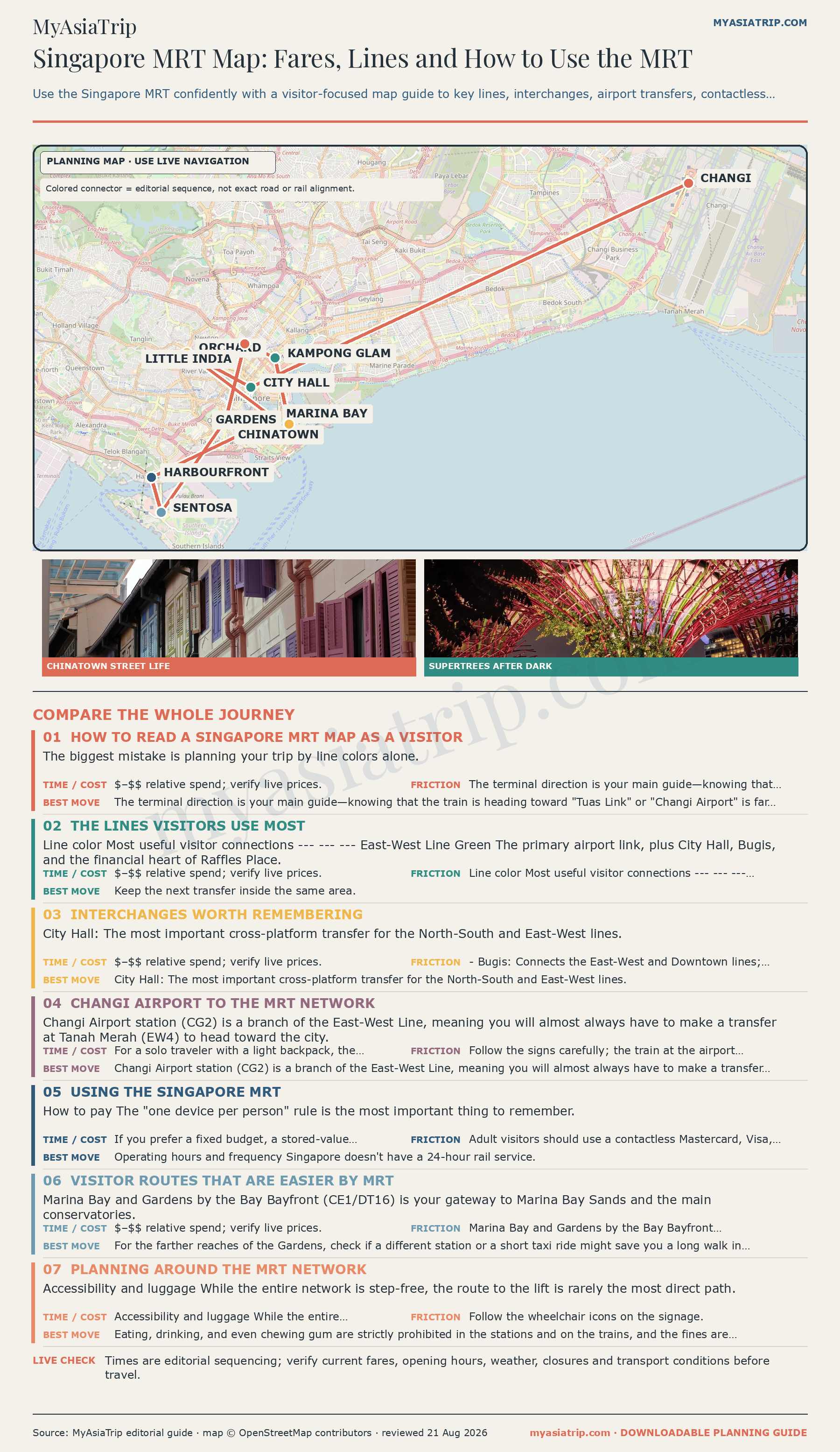
The Mass Rapid Transit (MRT) network spans six primary operating lines, more than 140 stations, and over 200 route kilometres. Trains are punctual, spotless, and fully air-conditioned, with services running reliably from approximately 05:30 in the morning until midnight daily.
Core lines every visitor uses
- North-South Line (Red Line / NS): Traverses the central retail and business artery, connecting Orchard Road (Orchard, Somerset, Dhoby Ghaut), the Civic District (City Hall), the Financial District (Raffles Place), and Marina Bay.
- East-West Line (Green Line / EW): The backbone linking Changi Airport (via transfer at Tanah Merah), heritage Bugis, City Hall, and industrial/residential western districts.
- Downtown Line (Blue Line / DT): Essential for culture and dining, directly serving Chinatown, the Singapore Botanic Gardens, Little India, and Kampong Glam (Bugis/Jalan Besar).
- North East Line (Purple Line / NE): Connects HarbourFront (the gateway to Sentosa), Chinatown, Clarke Quay, and Little India.
- Circle Line (Yellow Line / CC): Forms an orbital ring connecting the outer city centre, passing HarbourFront, Botanic Gardens, Marina Bay, and connecting East Coast suburbs via Paya Lebar.
- Thomson-East Coast Line (Brown Line / TE): The modern north-south transit corridor cutting through Upper Thomson, Orchard Boulevard, Maxwell (Chinatown hawker centres), Shenton Way, and the waterfront at Gardens by the Bay.
Key interchange stations
| Interchange station | Connecting lines | Why visitors use it |
|---|---|---|
| City Hall (NS25 / EW13) | North-South, East-West | Direct cross-platform transfer between Orchard and the East Coast corridor; gateway to National Gallery and Civic District hotels. |
| Dhoby Ghaut (NS24 / NE6 / CC1) | North-South, North East, Circle | Major tri-line underground hub at the eastern end of Orchard Road; connects shopping malls with museum districts. |
| Bugis (EW12 / DT14) | East-West, Downtown | Prime access for Kampong Glam, Arab Street boutiques, and Haji Lane cafes; alternative airport transfer corridor. |
| Chinatown (NE4 / DT19) | North East, Downtown | Central node for traditional shophouses, heritage temples, and Maxwell Food Centre. |
| HarbourFront (NE1 / CC29) | North East, Circle | Direct southern terminus linked to VivoCity mall, the Sentosa Express monorail, Mount Faber Cable Car, and cruise piers. |
| Marina Bay (NS27 / TE20 / CE2) | North-South, Thomson-East Coast, Circle | Access point for the southern financial district, Marina South Pier, and connection towards Gardens by the Bay. |
Station navigation and exit letters
One of the most common mistakes travelers make in Singapore is walking out of the wrong station exit. Because Singapore’s MRT stations are massive multi-level underground complexes spanning several city blocks, emerging from Exit A instead of Exit F can deposit you on the opposite side of an eight-lane boulevard under midday sun or during heavy rain.
Always check the overhead platform and concourse directory boards before tapping through the fare gates. Singapore stations use clear alphabetical exit designations (Exit A, Exit B, Exit C, etc.) accompanied by listings of nearby landmarks, major commercial buildings, and connecting street names.

Public buses: mastering the surface network
While the MRT handles rapid cross-city transit, Singapore’s bus fleet—operated by SBS Transit, SMRT, Tower Transit, and Go-Ahead—provides a scenic and comfortable way to observe the city’s streetscapes.
- Boarding and alighting: Passengers generally board at the front and leave through the middle or rear doors, tapping at both ends. Parents with open strollers and wheelchair users should follow the bus captain’s direction, as ramp boarding may use the rear door.
- Hail your bus: Singapore bus drivers do not automatically stop at every station along their route. When you see your incoming bus number approaching the stop, raise your hand clearly to signal the driver.
- Press the stop chime early: When you want to alight, press one of the red overhead or stanchion-mounted “Stop” buttons well before the bus reaches your stop.
- Bus stop identifiers: Every bus stop in Singapore is assigned a unique 5-digit Bus Stop Code (e.g., 03211, 01012) printed clearly on the shelter sign board. Using official journey planning apps like LTA’s MyTransport.SG or transport mapping utilities, you can input this 5-digit code to see real-time arrival estimates and verify your direction.
- Double-decker seating: If riding on the upper deck of a double-decker bus, note that standing is strictly prohibited on the upper level and staircases. Descend to the lower level only when the bus is coming to a complete halt at your stop.
Essential visitor transit corridors
To streamline your daily planning, here is how to navigate Singapore’s five most popular tourist transit routes:
1. City Centre to Sentosa Island
- The Gateway: Take the North East Line (Purple) or Circle Line (Yellow) to HarbourFront MRT Station (NE1 / CC29). Enter the adjacent VivoCity shopping mall.
- Sentosa Express Monorail: Head to Level 3 of VivoCity. The current island-entry fare is S$4; an EZ-Link card is accepted at the gate. Recheck fares and accepted products before travel.
- Sentosa Boardwalk (On Foot): Head to Level 1 of VivoCity and walk along the sheltered, landscaped boardwalk equipped with moving travelators. The scenic walk takes roughly 10–15 minutes and offers sweeping harbour views.
- Public bus: Route 123 currently links parts of the city with Sentosa for the normal distance fare, but routes and island stops can change; verify the live journey planner on the day.
- Singapore Cable Car: For scenic arrival, walk from HarbourFront station to HarbourFront Tower 2 and board the Mount Faber Line cable car across Keppel Harbour to Sentosa. Note that the Cable Car has two distinct lines (Mount Faber Line and Sentosa Line) across six stations; it is a premium attraction experience with separate ticketing rather than commuter transit.
- Internal Island Transport: Within Sentosa, the Sentosa Express, island buses and Beach Shuttle are currently free for internal journeys. The cable car is separately ticketed.
2. Changi Airport to City Centre
- MRT Rail Route: Changi Airport MRT Station (CG2) sits directly underground between Terminal 2 and Terminal 3.
- Board the train from Changi Airport, ride two stops to Tanah Merah (EW4), step across the platform (cross-platform interchange), and board the westbound East-West Line train directly into Bugis, City Hall, or Raffles Place.
- Alternatively, ride one stop to Expo (CG1 / DT35) and transfer to the Downtown Line (Blue) for direct access to Little India, Chinatown, and Marina Bay.
- Terminal Transfers: Terminal 1 connects seamlessly to T2 and T3 via the free elevated Skytrain. Terminal 4 passengers take a complimentary 24-hour airport shuttle bus to Terminal 2 to access the MRT.
- Airport Bus 36: Departs from the basement bus bays of Terminals 1, 2, and 3, offering an economical, luggage-rack equipped direct scenic route along East Coast Parkway into Marine Parade, Suntec City, and Orchard Road.
- Late Arrivals & Heavy Luggage: Last-train times vary by terminal connection and day. Check the official journey planner after landing; if service has ended or the family has several large bags, use the official taxi stand or a pre-arranged vehicle. Explore full options in our Changi Airport to city transit guide.
3. City Centre to Mandai Wildlife Reserve (Singapore Zoo, Night Safari, River Wonders, Bird Paradise)
- Mandai Khatib Shuttle: Take the North-South Line to Khatib MRT Station (NS14) and use Mandai’s current shuttle connection. Frequency, fare and payment method can change, so confirm them on Mandai’s official transport page before setting out.
- Public Bus 138: Connects from Ang Mo Kio MRT Station (NS16) bus interchange directly to the Mandai parks.
- Public Bus 927: Connects from Choa Chu Kang MRT Station (NS4 / JS1) directly to Mandai.
- Taxi / Ride-Hail: If travelling as a family of three or four, taking a Grab, Gojek, or metered taxi from central city hotels takes roughly 25–35 minutes and saves significant walking and transfer time.
4. Exploring Marina Bay and Gardens by the Bay
- Bayfront MRT (DT16 / CE1): Direct underground access to Marina Bay Sands, the Shoppes, and the underground connecting walkway to Gardens by the Bay (Supertree Grove and Domes).
- Gardens by the Bay MRT (TE22): Direct drop-off at the southern perimeter of the gardens and the Floral Fantasy precinct via the Thomson-East Coast Line.
- Promenade MRT (CC4 / DT15): Best for Singapore Flyer, Millenia Walk, and the northern side of Marina Bay.
5. Historic Quarters: Chinatown, Little India & Kampong Glam
- Chinatown: Use Chinatown MRT (NE4 / DT19) for pagoda streets and souvenir markets, or Maxwell MRT (TE21) for direct access to Maxwell Food Centre and the Buddha Tooth Relic Temple.
- Little India: Use Little India MRT (NE7 / DT12) for Tekka Centre wet market and hawker stalls, or Farrer Park MRT (NE8) for Mustafa Centre shopping.
- Kampong Glam: Take the East-West or Downtown Line to Bugis MRT (EW12 / DT14) and walk 6 minutes north to Sultan Mosque and Arab Street.
Metered taxis and on-demand ride-hailing
Taxis and ride-hailing apps provide essential point-to-point comfort when tropical temperatures peak or when navigating early-morning airport departures.
Metered taxis
- Street hails vs. Taxi stands: In Singapore’s Central Business District (CBD) and along Orchard Road, taxis are legally prohibited from picking up passengers along roads with double yellow lines or bus lane zones. You must join a queue at an official, marked Taxi Stand (found outside every hotel, shopping mall, and MRT interchange).
- Payment: Official taxis accept cash, local NETS, and major credit cards (Visa, Mastercard, Amex). Credit card payments incur an administrative surcharge of 10%.
- Surcharges: Regulated statutory surcharges apply on top of the metered rate, including peak-hour surcharges (25% of metered fare on weekday mornings and evenings), late-night surcharges (50% of metered fare between midnight and 05:59), CBD entry fees, and airport pickup surcharges.
Ride-hailing apps (Grab, Gojek, Tada)
- App setup: Download Grab (the region’s dominant super-app), Gojek, or Tada before arriving. Link your international credit card for seamless automatic cashless payment.
- Child seat safety regulations: Passengers under 1.35m must use an approved child restraint in private-hire cars. Metered taxis are legally exempt, but exemption is not a safety recommendation. Bring an appropriate portable restraint, book a child-seat vehicle category where available, or confirm the arrangement with the operator before travel.
Pre-booked airport transfers vs. public transit
For standard daily sightseeing, pre-booking private chauffeurs is an unnecessary expense given Singapore’s extensive public transit. However, on airport arrival and departure legs, pre-booked vehicles provide significant peace of mind when managing multiple heavy bags, late-night red-eye flights, or multi-generational family groups.
| Transfer type & vehicle tier | Best suited for | Key operational trade-offs |
|---|---|---|
| Shared Changi Airport Shuttle · Solo travelers with standard luggage | Solo travelers arriving during daytime hours seeking lower cost than private taxi | Must wait for other arriving passengers; fixed drop-off routes at participating hotels only; no large strollers. |
| Private Changi Airport Car · Families with heavy luggage & night arrivals | Seamless, door-to-door arrival after long-haul flights or late-night touchdown | Higher fixed cost than metered taxi queues if airport lines are completely empty. |
| Private 4, 6 or 13-Seater Minivan · Group travel with excessive luggage | Large family groups (5–9 people) who would otherwise require two separate metered taxis | Must accurately tally total luggage pieces and child booster requirements during booking. |
| Roundtrip Private Changi Transfer · Coordinated arrival & early departures | Early-morning 06:00 flight departures when MRT network is closed and taxi queues are unpredictable | Inflexible if flight dates or hotel accommodations change last-minute. |
Walking, cycling, and active mobility
Singapore’s government has invested heavily in urban walking and cycling infrastructure under the national “Walk Cycle Ride” initiative.
- Sheltered covered walkways: Major residential precincts, bus interchanges, and MRT stations are connected by extensive networks of covered linkways (Sheltered Walkways). These white-roofed pathways protect pedestrians from equatorial sun and tropical storms.
- Park Connector Network (PCN): Over 300 kilometres of paved, landscaped recreational greenways link parks across the island. The coastal path running along East Coast Park is the best location for leisure cycling, rollerblading, and breezy seaside dining at the East Coast Lagoon Food Village.
- Shared cycling rules: Shared commercial bicycles (such as Anywheel) can be unlocked via mobile app. Under LTA active mobility regulations, cyclists must ride on dedicated cycling paths or park connectors where available. If riding on public footpaths, cyclists must yield right of way to pedestrians and keep within the statutory 10 km/h speed limit. All shared bikes must be parked inside designated yellow bicycle parking boxes and scanned via QR code upon return to avoid non-compliance penalty fees.
Accessibility, strollers, and travelling with families
Singapore’s public transport has broad step-free provision, though the easiest route is not always the shortest one on the map.
- Step-free MRT accessibility: MRT and LRT stations provide barrier-free routes, wide gates, tactile guidance and lifts. Follow accessibility signs rather than assuming the nearest street exit is step-free.
- Wheelchair accessible buses (WAB): Singapore’s public bus fleet is wheelchair-accessible, with boarding ramps deployed by bus captains. Wheelchair users have priority in the designated shared space.
- Open stroller guidelines: Open, unfolded strollers are permitted on all public trains and buses. On public buses, parents may board with an unfolded stroller provided it does not exceed 120 cm in length and 70 cm in width. If a passenger using a wheelchair boards the bus, the wheelchair user takes legal priority, and parents must fold their stroller to vacate the safety bay.
- Air-conditioned relief: When walking with young children or seniors, navigate through interconnected basement shopping concourses (such as the sprawling underground networks connecting City Hall, Esplanade, and Raffles City) to avoid surface heat and humidity.
Practical rules and etiquette for smooth transit
To keep the network safe and clean, follow these practical rules:
- Do not eat or drink in the MRT paid area or on trains. Finish snacks and drinks before entering the fare gates.
- Avoid carrying strong-smelling durian on public transport. Follow posted operator conditions.
- Stand on the left of escalators: When riding station escalators, always stand on the left-hand side, leaving the right-hand lane clear for commuters walking or rushing past.
- Queue behind platform markings: Wait behind the yellow safety lines on MRT platforms, leaving the central doorway zone open for arriving passengers to alight completely before stepping forward to board.
- Priority seating: Give up designated “Priority Seats” (clearly marked in distinct colors near vehicle doors) to elderly passengers, expectant mothers, commuters with mobility challenges, or parents carrying infants.
Summary checklist for getting around Singapore
- Card selection: Tap a personal contactless bank card or mobile wallet (SimplyGo) for low-stress payment, ensuring each family member has an individual card.
- Consistency: Always tap in and tap out with the exact same physical card or device to avoid double maximum fare charges.
- App tools: Use LTA’s MyTransport.SG or live transit maps to check real-time bus arrivals and five-digit stop codes.
- Navigation: Identify your destination’s exact MRT Exit Letter before clearing underground fare gates to prevent long detours in the heat.
- Peak hour strategy: Avoid commuting between 07:30–09:00 and 17:00–19:00 on weekdays when central interchanges experience heavy passenger density.
- Sentosa transition: Monorail, boardwalk, bus and cable car connect HarbourFront with Sentosa; the listed internal monorail, bus and beach-shuttle services are currently free within the island, while the cable car is ticketed.
- Late night backup: Trains and standard buses stop running around midnight. Have the Grab app configured or head to an official hotel taxi stand for dependable late-night returns.
Quick answers
Frequently asked questions
What is the best way to get around Singapore?
How do I pay for public transport in Singapore?
Can two people share one credit card or EZ-Link card on Singapore public transport?
Research notes
Official planning references
We use these primary references for the time-sensitive details relevant to this guide. Rules, prices and operating hours can change, so confirm the live information before you travel.
Details to check: Distance fare calculation, transfer limits, and payment methods checked 2026-09-11
Details to check: MRT lines, station operating hours, and single-trip ticket phase-out verified 2026-09-11
Details to check: EZ-Link sales locations, card fee non-refundability, and SimplyGo Ticket Office refund policy verified 2026-09-11
Details to check: Foreign card daily administrative fee terms checked 2026-09-11
Details to check: Wheelchair accessibility and open stroller transit guidelines checked 2026-09-11
Details to check: Sentosa Express, boardwalk, internal buses, and cable car network verified 2026-09-11
Guide reviewed 11 September 2026. Confirm live rules, prices and operating details with the linked authority before travel.